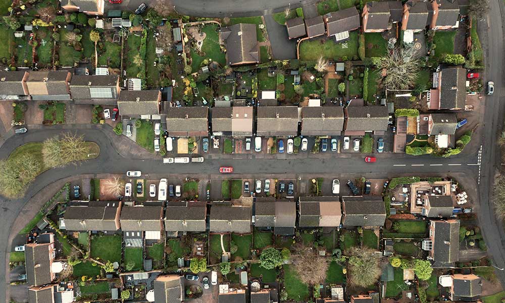
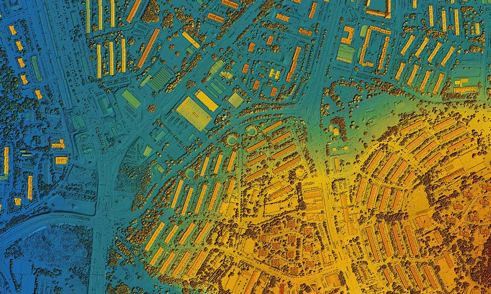
LiDAR-equipped drones can quickly and accurately create high-resolution 3D maps of areas that are difficult or dangerous to access by traditional methods. This can be useful in a wide range of industries, from construction and mining to environmental monitoring and agriculture.
LiDAR MAPPING
LiDAR mapping, also known as Light Detection and Ranging mapping, is a remote sensing technology that uses laser light to create 3D maps of the surface of the earth. The technology works by emitting a laser beam from a sensor and measuring the time it takes for the beam to bounce back after hitting a surface.
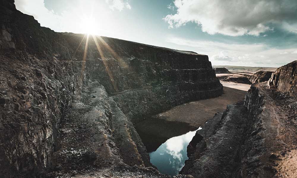
Quarries & Mining
Autonomously measure stockpile volumes and manage inventory across all their sites because it produces data that is up to 80% more accurate than manual measurement. The data is accessible by the entire team for analysis and can also easily be used in operational systems. Our data sets include Orthomosaic Imagery, Digital Terrain Models and Contours, LAS Point Clouds, Stockpile Volumetrics, and Cut/Fill Calculations
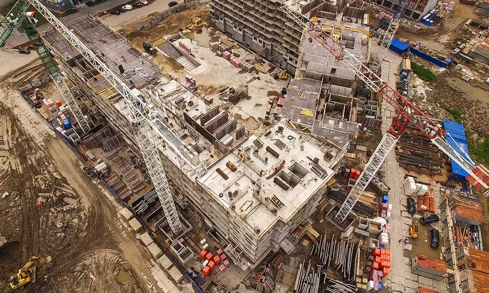
Aerial Photo/Videography
We offer a comprehensive suite of aerial photography and videography services, designed to showcase the beauty and grandeur of your projects from above. Capture stunning vistas, towering mountains, sprawling coastlines, and intricate cityscapes from a whole new perspective. Document the progress of construction projects from start to finish with accurate and detailed aerial imaging.
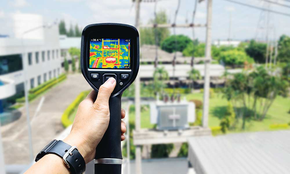
Thermal Inspection
Thermal inspection is used in a wide range of applications, including building inspections, electrical inspections, and mechanical inspections. In building inspections, thermal imaging can be used to detect insulation defects, air leaks, and moisture intrusion. In electrical inspections, thermal imaging can be used to detect hotspots in electrical equipment, indicating potential electrical faults. In mechanical inspections, thermal imaging can be used to detect abnormal heat patterns in machinery, indicating potential mechanical problems.
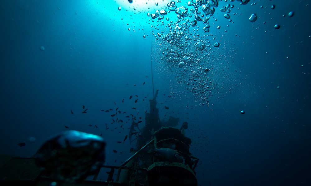
Underwater Inspection
Underwater inspection is the process of visually examining the condition of underwater structures, such as pipelines, bridges, dams, ships, and other submerged infrastructure, to identify potential problems and ensure their proper functioning. Underwater inspections are typically carried out using specialized equipment and techniques that allow inspectors to access and examine the underwater structures safely and effectively.
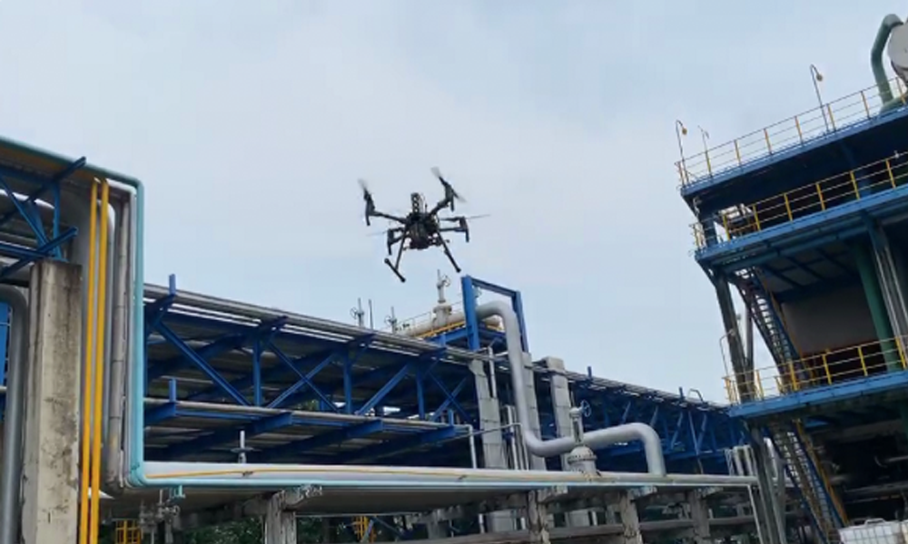
gas detection & mapping system
A gas detection and mapping system is a technology used to identify and visualize the presence of gases in an area, typically for safety, environmental monitoring, or industrial inspection. It uses sensors to detect gas concentrations in the air and combines this data with GPS coordinates to create detailed maps showing the location and intensity of gas leaks or emissions. This system can be mounted on drones, vehicles, or handheld devices, allowing for efficient and accurate coverage of large or hard-to-reach areas.
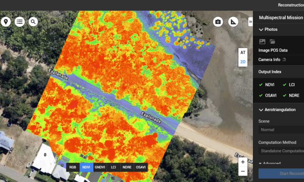
Multispectral Imaging
Aerial multispectral imaging is a remote sensing technique that uses drones or aircraft equipped with special cameras to capture images in multiple wavelengths of light, including visible and non-visible bands like near-infrared. This technology allows users to analyze vegetation health, soil conditions, water quality, and other environmental factors that are not visible to the naked eye. It is widely used in agriculture, forestry, environmental monitoring, and land management to make data-driven decisions and improve resource efficiency.
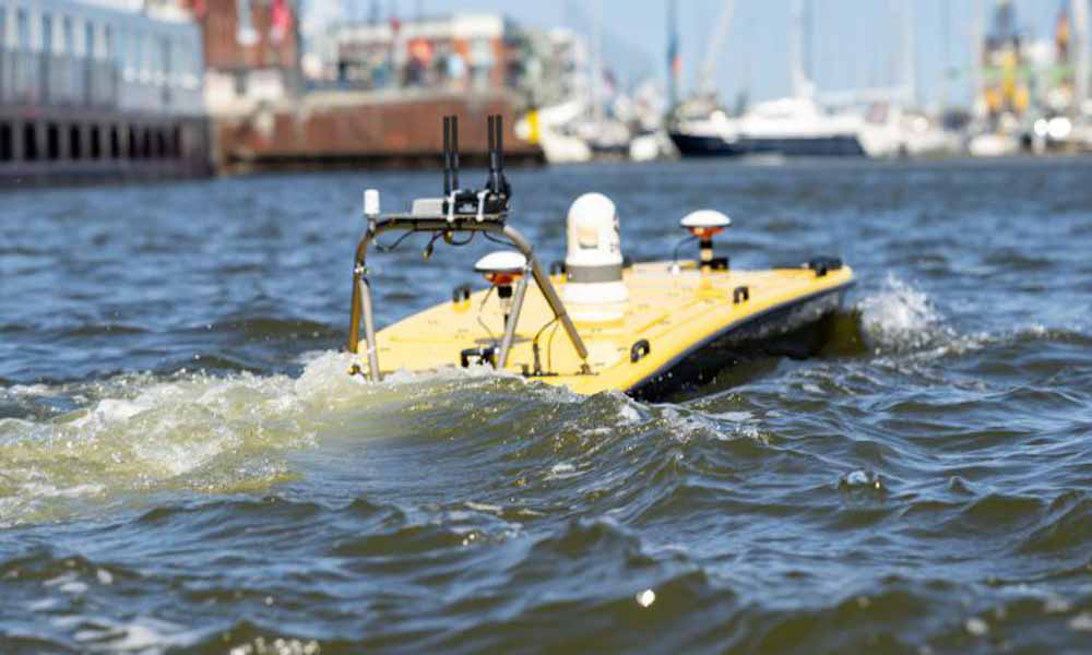
Bathymetric surveys
The primary objective of bathymetric surveys is to generate accurate and detailed depth maps, also known as bathymetric maps, which are crucial for various applications. These applications include navigation, marine resource management, environmental monitoring, geological studies, and infrastructure planning. Bathymetric surveys contribute significantly to enhancing safety in maritime navigation by providing up-to-date information about underwater terrain and potential hazards.
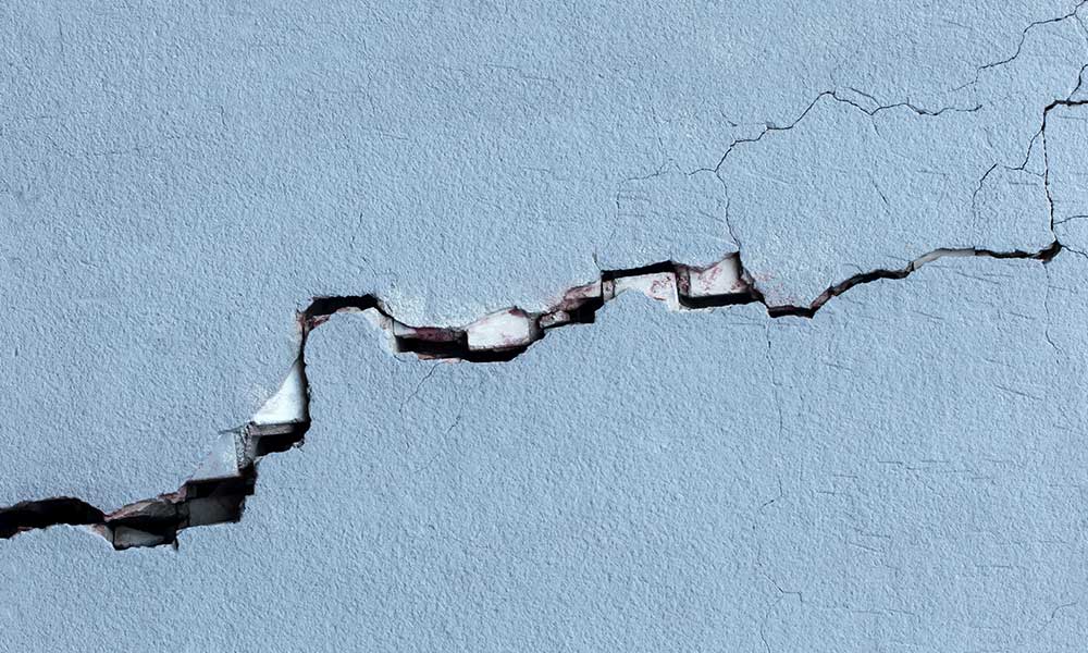
Building Facade Inspection
Maintaining the safety and integrity of your building’s facade is crucial. Over time, facades can be exposed to various elements that can cause damage, such as wind, rain, and sun. This damage can lead to leaks, cracks, and other problems that can be costly to repair. Our building facade inspection services are designed to help you identify potential problems early on and make informed decisions about repairs and maintenance.
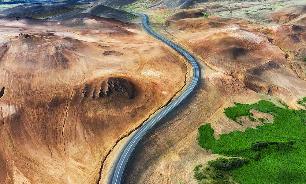
Environmental Monitoring
Drones have become an invaluable tool for environmental monitoring. These versatile, unmanned aerial vehicles (UAVs) offer a unique perspective, allowing researchers and conservationists to collect data and observe changes in ecosystems with unprecedented detail and efficiency. Drones equipped with high-resolution cameras can map vast forested areas, monitor deforestation, and identify areas affected by disease or pests.
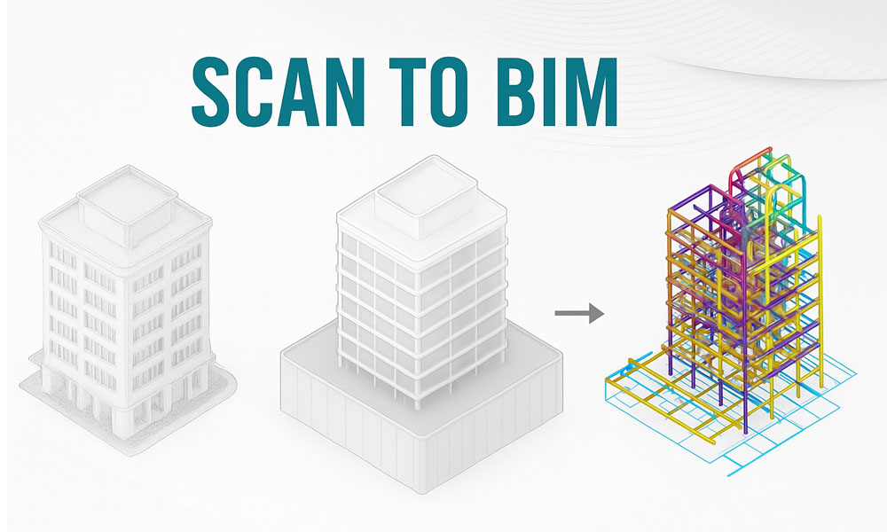
SCAN TO BIM
Scan to BIM is the process of capturing existing building conditions using 3D laser scanners or drones and converting the data into accurate Building Information Models (BIM). It enables detailed visualization, analysis, and documentation of as-built environments. Ideal for renovation, facility management, and clash detection, Scan to BIM improves planning accuracy and reduces risks by providing a digital twin of real-world structures.