Introducing the cutting-edge DJI Zenmuse L2 LiDAR payload, designed to elevate your aerial surveying and mapping capabilities to unprecedented heights. Tailored for seamless integration with the DJI Matrice 350 and 300 series, this innovative LiDAR solution packs a powerful punch with its high precision and exceptional efficiency. The Zenmuse L2 is engineered to deliver superior penetration, providing you with the ability to capture critical data beneath dense canopies and complex structures. With a detection range spanning an impressive 250 meters to 450 meters and the capability to return up to 5 data points from a single pulse, this payload offers the precision and coverage you demand for your surveying projects.
Effortlessly transform your data acquisition process with the DJI Zenmuse L2, a turnkey solution that simplifies the LiDAR scanning workflow. Real-time Point Cloud LiveView ensures you capture the right data as it happens, optimizing your decision-making on the fly. The one-click processing feature, seamlessly integrated with DJI Terra, streamlines data management and analysis, allowing you to focus on your project’s critical insights rather than spending hours on data processing. Elevate your surveying and mapping capabilities to new heights with the DJI Zenmuse L2 LiDAR payload – precision, efficiency, and ease of use have never been so accessible
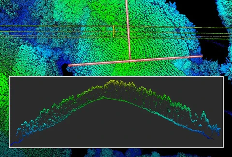
An Integrated LiDAR Solution
Supported by its powerful hardware, L2 can allow for a precise scan of complex subjects within an extended range and faster point cloud acquisition. During operations, users can preview, playback, and process point cloud models on-site, with Task Quality Reports generated by DJI Terra, offering a simple, one-stop solution to improve overall efficiency. This enables users to achieve high-precision point cloud results with one-stop post-proces